Strong Storms Could Bring Damaging Winds Across Indiana

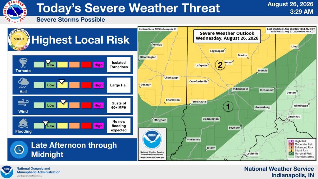
STATEWIDE — Thunderstorms are expected to develop across central Indiana Wednesday afternoon and evening, with the Indianapolis metro area potentially seeing storms between 7 and 10 p.m.
“We’re definitely going to see thunderstorms later this afternoon and this evening developing across central Indiana,” said Casey Crosby, a forecaster with the National Weather Service in Indianapolis.
Crosby says the timing for the metro area will depend on how quickly storms move in from Illinois and northwestern Indiana.
“The only main threat is going to be some strong, damaging wind gusts, possibly as high as 60 to 65 mph,” Crosby said.
Crosby says forecasters are not expecting a significant threat from hail or tornadoes.
“We’re not seeing any threat for hail or even tornadoes,” he said.
Widespread flooding also is not expected. Crosby says most areas should see less than an inch of rain, although isolated higher amounts are possible.
“Overall, rainfall amounts should be under an inch with this activity,” Crosby said.
Crosby says rivers have fallen significantly over the past week, with the remaining river flooding mainly along the Wabash River Valley and portions of the White River in southern Indiana.
“The rivers are much better than they were even just a few days ago and they continue to fall,” he said.
Crosby says the additional rainfall should not cause substantial rises on area rivers or creeks.
“Even though we’re going to get this rain, it’s not enough to really cause any substantial rises on any of the rivers, and that includes even the creeks,” Crosby said.