When Severe Storms are Possible in Indiana
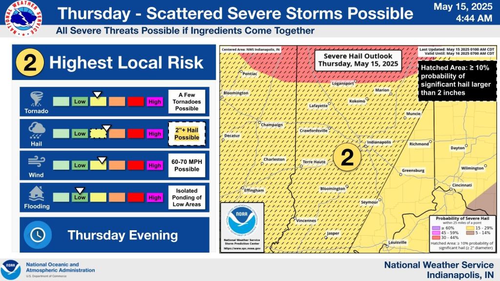
INDIANAPOLIS — Strong to severe storms are expected to move through central Indiana this evening. That means there’s a chance for damaging winds, large hail, and possibly a tornado.
It’s already hot and humid with temperatures climbing into the upper 80s, close to record highs. A few isolated storms popped up this morning, but the main concern comes later tonight.
The highest chance for severe weather is between 7 p.m. and 3 a.m. Friday. While it’s still unclear how many storms will form, the conditions are right for some to turn severe. Damaging winds are the main threat, but hail and isolated tornadoes are also possible.
It will stay warm and muggy overnight with lows in the upper 60s to low 70s.
Another round possible Friday night
Friday will bring more heat and humidity. Most of the day should stay dry, but strong storms could return by late afternoon or evening.
Forecasters say the window for severe weather on Friday is between 5 p.m. and 11 p.m. damaging winds are again the main concern, but large hail and a few strong tornadoes are also possible, especially south of Interstate 70.
The storms should move out around midnight.