NWS: Severe Storm Risk, Triple-Digit Heat Index in Indiana

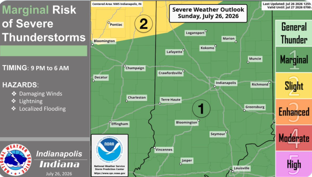
STATEWIDE — Strong winds and possible severe storms are on the agenda for Monday.
“There will be another round potentially moving in either late in the day into the evening hours or potentially into the overnight hours,” White added. “We do have more concern with the second round for Monday night into Tuesday, compared to Sunday night into Monday.”
While heavy rain is expected with these systems, flooding risks remain low.
“Thankfully, it’ll be moving fast enough to limit some of the flooding potential,” White said.
Forecasters say Monday will also bring a spike in summer heat before cooler air arrives mid-week.
“We’re going to see temperatures across the state in the low 90s for Monday,” White noted. “It’ll be a little bit cooler after the storms on Tuesday. Temperatures are supposed to be in the mid to upper 80s for most of Indiana and near 90 across the south. We’re going to see pretty similar conditions as we go through the rest of the week.”
Heat index values on Monday could reach between 100 and 105 degrees across much of the state.
“Tuesday doesn’t look as bad just because we don’t have dew points that high, but heat index values will be in the low to mid-90s,” White said. “Conditions will be very similar through at least Wednesday before those lower dew points start to help things out.”
Forecasters note there is still uncertainty regarding exact timing, but any severe storms that do develop will carry the potential for damaging winds capable of causing power outages.