Indiana Storms Fade as Dry Stretch Begins
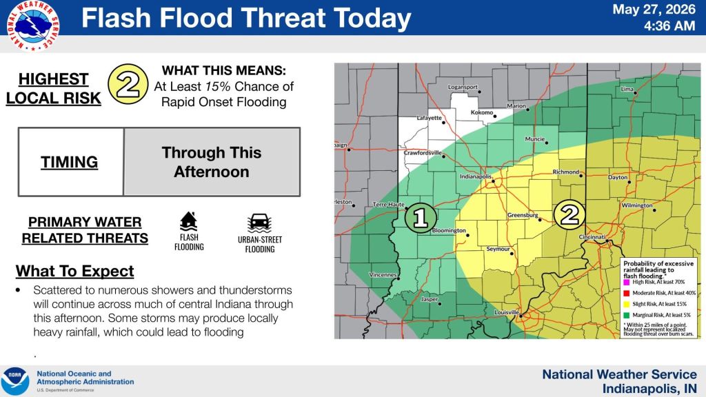
INDIANAPOLIS — Scattered showers and a few embedded thunderstorms are moving across parts of central Indiana early Wednesday, bringing on-and-off rain and lightning.
More scattered showers and storms will continue into the afternoon, with some brief breaks of sunshine in between. The severe weather risk stays low, but a few heavier downpours and lightning strikes are still possible. Highs will be in the upper 70s with humid air sticking around.
Rain will gradually move out from northwest to southeast later this evening as a cold front pushes through the state, clearing skies and cooling things down overnight. Lows will dip into the lower 60s, and some areas could see fog develop, locally dense in spots.
Thursday turns quieter with a mix of sun and clouds, a breezy northeast wind, and noticeably lower humidity. That sets up a longer stretch of dry weather with plenty of sunshine in the days ahead.