National Weather Service Confirms EF2 Tornado in Monroe County
MONROE COUNTY, Ind. — The National Weather Service confirmed that an EF2 tornado touched down in Monroe County Thursday night.
An EF2 tornado means a “significant or strong” classification on the Enhanced Fujita scale. NWS determined that peak winds reached 120 mph with the tornado starting in south Ellettsville just before 7 p.m. Thursday.
“It did most of the damage on the west side of Bloomington,” said Chad Swain, a meteorologist with the National Weather Service in Indianapolis.
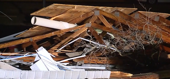
The tornado reportedly lasted 9 minutes, touching down over a 3.7-mile stretch of land. NWS crews went out to the area on Friday to conduct storm surveys.
“You look at the damage to figure out how strong the winds were, and that’s what we do to come up with those estimates on the EF scale,” Swain said.
Thankfully, no injuries or deaths were reported from the tornado that ended in Bloomington. The severe storm system did damage dozens of homes and buildings, including the local airport, a bank, and a car dealership.
Justin Baker with the Monroe County Emergency Management said if you need to travel through his county, please be respectful.
“If you don’t live in the county, try not to sightsee in the damaged areas,” Baker told WIBC.
Cleanup efforts continue into the weekend. Baker added that in residential areas, there’s a lot of shingles off of roofs, but nothing significant.
“There are no majorly destroyed houses like with the last couple of tornadoes we’ve had,” he said.
Over in Sullivan County, Swain said winds were as strong as 85 mph from an EF0 tornado that touched down there Thursday night. Most of the damage was in the Town of Carlisle and to trees.


