Severe Storm Risk Rises Across Indiana
INDIANAPOLIS — Straight-line wind damage is the primary threat as storms move across Indiana this afternoon and evening, with the greatest risk focused south and east of downtown Indianapolis.
Scattered showers and possibly an isolated thunderstorm are moving through the state this morning. It’s already warm and humid outside, and the sticky conditions will continue throughout the day.
By mid to late morning, forecasters expect scattered convection to develop across Central Indiana. Some storms may reach severe levels, and the threat window will stay open into the evening.
An approaching cold front will add fuel to the atmosphere, with added heat and instability creating the potential for stronger storms to develop between 3 p.m. and 8 p.m.
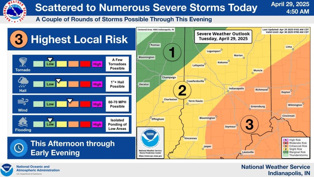
The Storm Prediction Center has upgraded parts of central, eastern, and southern Indiana to an enhanced risk—level 3 out of 5—for severe thunderstorms this afternoon.
The rest of central Indiana remains under a slight risk, or level 2. In all areas, straight-line winds are the main concern.
Storm activity should begin to taper off after dinner as the cold front shifts south. Cooler, drier air will follow, and storms will exit west to east by late tonight. Overnight lows will fall into the lower 50s, with some patchy fog possible by morning.