NWS: Shifts in Temperature and Rainfall Expected in the Coming Days

Source: X (Formerly known as Twitter) / X (formerly known as Twitter)
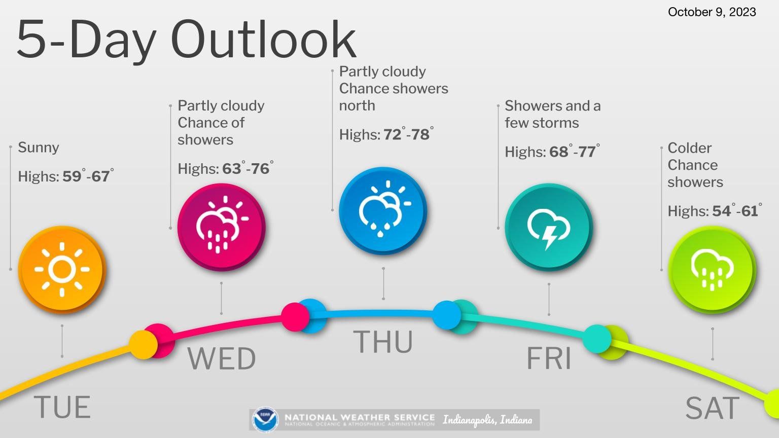
INDIANAPOLIS — Hoosiers can expect another temperature shift as the week goes on. This afternoon, we’ll have sunny skies with temperatures reaching the lower 60s.
National Weather Service forecaster Alexander McGinnis says as the evening rolls in, the weather will remain clear, and temperatures will drop to the upper 30s.
“We’re getting into autumn now, and we’re getting more of a flow out of the Northwest with some Canadian high pressure coming down that cools us out like the weather we’ve been seeing the past few days.”
Wednesday, the day will start with partly cloudy conditions and a slight chance of showers in the morning. Later in the afternoon, the skies will become mostly cloudy with a chance of showers. The likelihood of rain is around 50 percent.
Wednesday night will transition from partly cloudy conditions through midnight to clearing skies. There’s still a 50 percent chance of showers, and the night won’t be as cool, with temperatures settling in the lower 50s.
Looking ahead to Thursday, expect mostly sunny skies and noticeably warmer weather, with highs reaching the upper 70s. At night, we’ll start with mostly clear skies through midnight, but it will become partly cloudy as the night progresses. Lows will settle in the mid-50s.
On Friday, the day will begin with partly cloudy conditions and a chance of morning showers. Later in the afternoon, it will turn mostly cloudy with showers likely. Highs will be in the mid-70s, with a 60 percent chance of rain.
Friday night could bring more weather, including showers and a slight chance of thunderstorms through midnight, followed by a continued chance of showers with a possibility of thunderstorms toward daybreak. Overnight lows will be in the mid-50s, with the chance of rain at 80 percent.