Indiana Faces Heat, Storm Threat
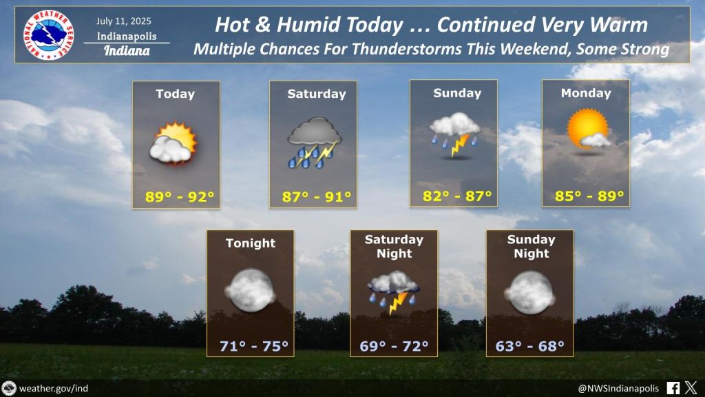
INDIANAPOLIS — Scattered strong storms could move across Indiana on Saturday, bringing gusty winds and heavy downpours to parts of the state. The storm threat follows a hot and humid Friday, with highs in the upper 80s to around 90.
The National Weather Service says the greatest risk for severe weather will come Saturday afternoon and evening. While storms won’t be constant, the strongest could produce wind gusts over 60 miles per hour, lightning, and brief heavy rain. Northeastern Indiana is currently expected to see the most intense activity.
The heat and humidity will help fuel storm development. Dew points in the low to mid-70s are making conditions feel tropical across much of the state. A cold front moving through late Sunday will help bring some relief.
Storm chances will continue on and off from Saturday afternoon through early Sunday. Most of the state is under a Level 1 or 2 severe weather risk. Forecasters say timing for the strongest storms is between 3 p.m. and 11 p.m. Saturday.
Sunday brings a chance for lingering showers in the morning, followed by clearing skies and continued warm, humid weather into the afternoon.