Severe Storms Hit Indiana This Weekend
Source: @NWS / @NWS
INDIANAPOLIS — Severe storms are headed our way late Friday night into Saturday, bringing a big change in the weather.
“It’s looking like it’ll be an overnight event,” said Cody Moore, a forecaster with the National Weather Service. “It’ll likely hit the Illinois/Indiana border just around or after sunset, then move through the rest of Central Indiana.”
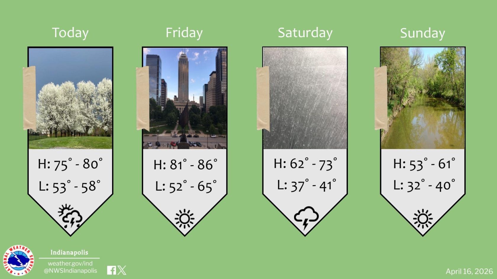
Before that, Thursday and Friday will stay warm, with highs in the 70s and a mix of sun and clouds. A slight chance of showers is possible in the southern counties Thursday afternoon, but most of the area will see another nice day.
Moore said the biggest risk during this storm is strong, damaging winds.
“There’s a lower chance of tornadoes and hail,” he said. “But damaging straight-line winds are the main concern, especially along and west of I-65, and Indianapolis is in that zone.”
With rain and storms moving in overnight, Saturday will bring a bigger shift. Expect some dry periods during the day, but strong winds and rising temperatures will make it feel warmer.
A cold front moves through late Saturday, bringing cooler air by Sunday along with lingering showers.
Right now, skies are clear and temperatures are in the low 40s for the morning commute. It’s another dry start to the day, with highs expected to reach the low 70s downtown, continuing the streak of nice weather.