Cold Start Gives Way to Weekend Warmup
AUDIO: Cold Start Gives Way to Weekend Warmup
Source: X / @NWS
INDIANAPOLIS — Drier air has moved in, clearing out the last of the flurries. While some icy spots may remain on roads, driveways, and sidewalks, interstates are expected to be clear for the morning commute.
Winds remain brisk, keeping a winter chill across the Ohio Valley.
“That should be calming down through the afternoon and then around sundown much lighter winds and a very nice evening,” said Alex McGinnis, a forecaster at the National Weather Service.
Afternoon temperatures are expected to reach the low 40s, with northwest winds at 10-20 mph making it feel even colder, with wind chills in the 20s and 30s.
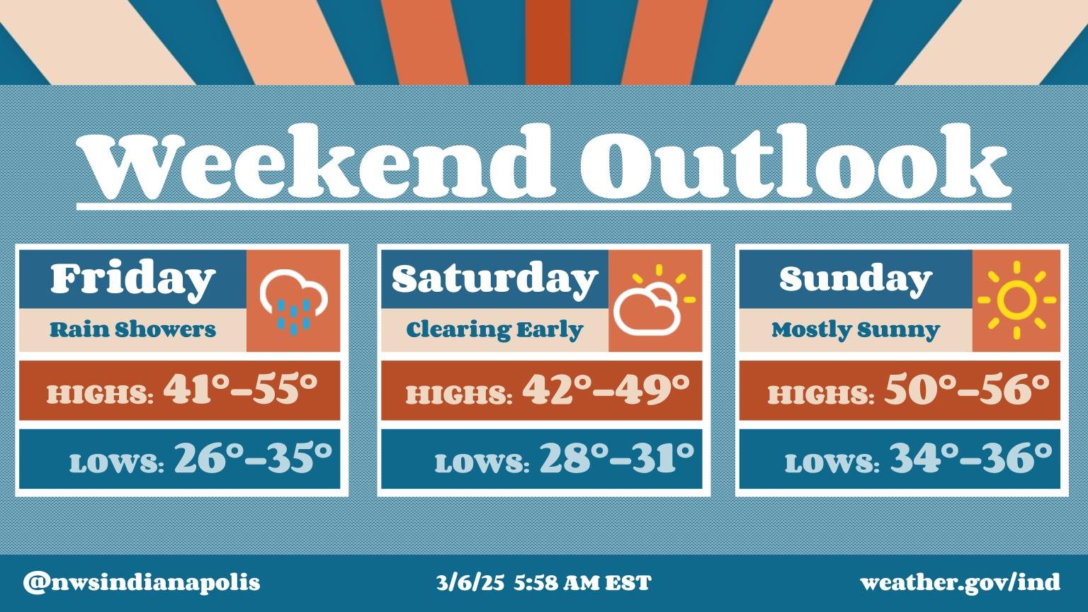
Friday will bring a mix of light snow in the morning, shifting north before transitioning to rain in central Indiana by the evening. Some sunshine is expected in between, particularly south of Indianapolis. Temperatures will vary, reaching the 50s in southern Indiana and the 30s to the north.
The weekend looks dry, with sunshine building Saturday afternoon and a warming trend heading into next week.
“Sunday we will be in the 50s, Monday we’re thinking 60s, Tuesday we could have a lot of the area in the 70s,” McGinnis said


