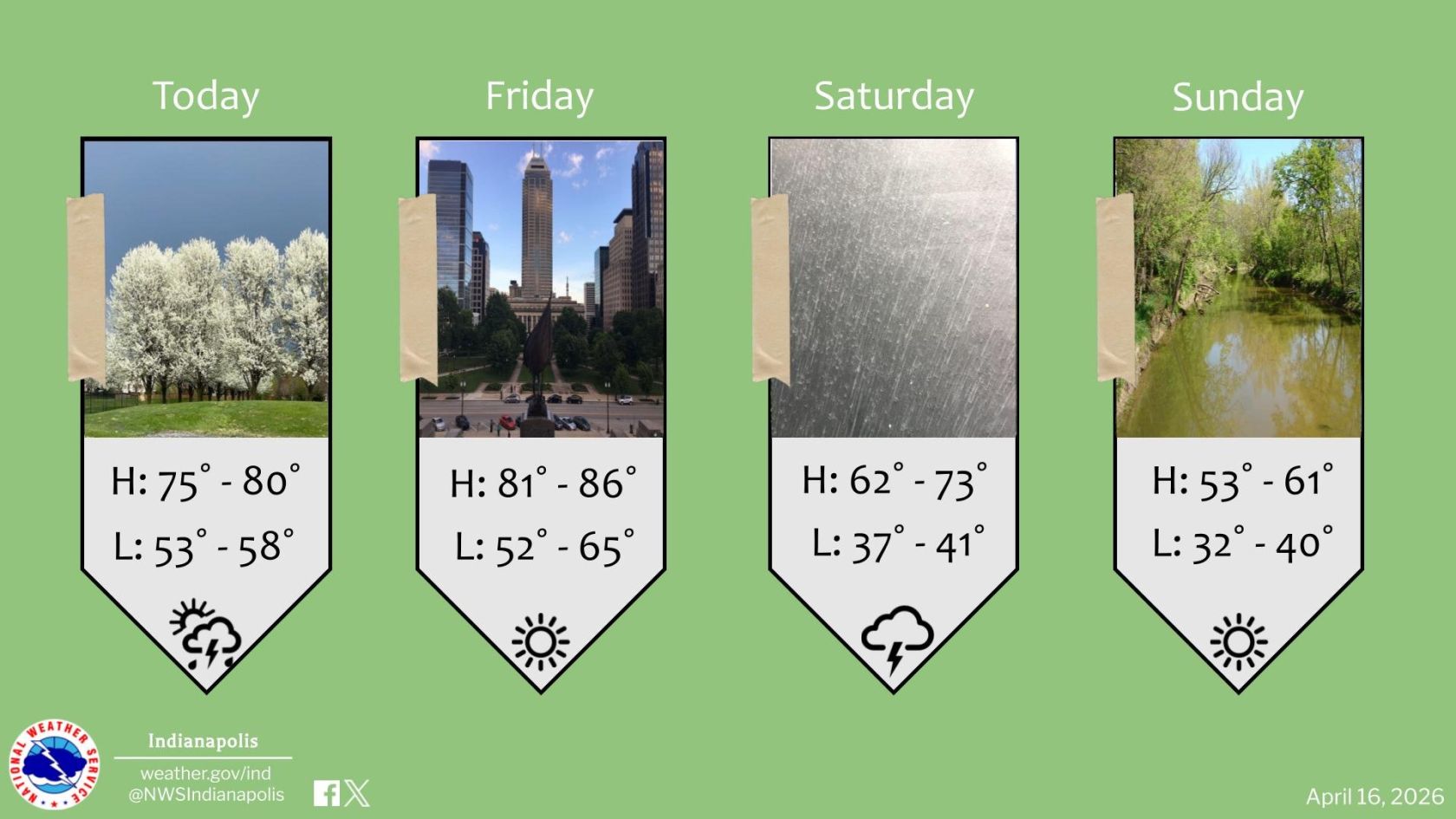
Heavy Rain, Storms, and Snow Showers
Heavy Rain, Storms, and Snow Showers Expected Tonight
Source: X / @NWS
INDIANAPOLIS— Heavy rain and thunderstorms will move through central Indiana tonight. Wednesday’s temperatures will drop as the rain transitions to snow showers.
Temperatures will reach the low 60s this afternoon as Indiana sits in the system’s warm sector, with southerly wind gusts up to 40 mph. A break in the rain is expected before heavier showers return after 5 p.m., moving west to east.
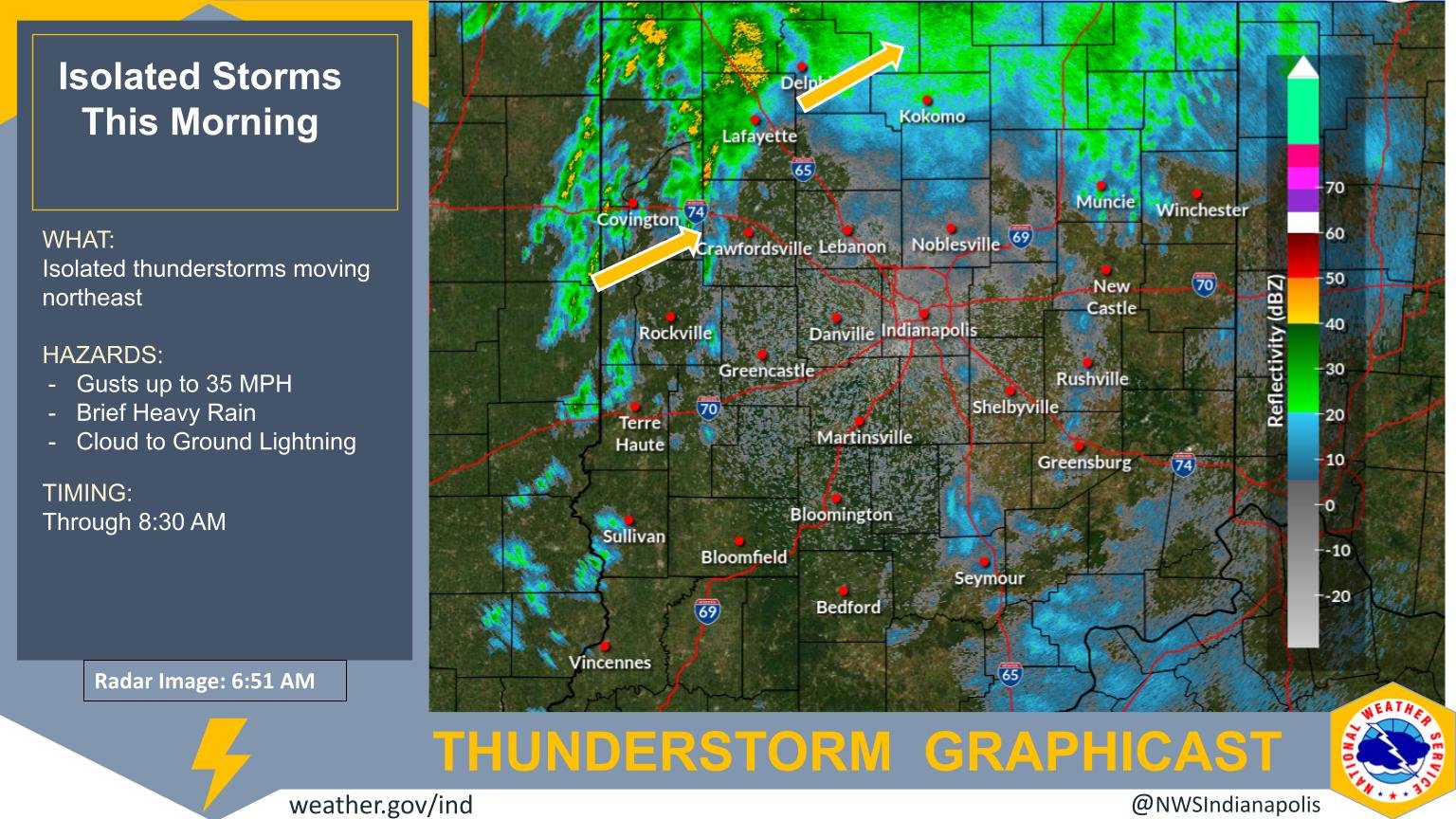
While the risk of severe storms is low, a few thunderstorms are possible. Heavy rain may cause localized flooding, with most areas receiving 0.5 to 1 inch before the system exits Wednesday evening.
Rain showers will continue Wednesday as moisture wraps around the system, with temperatures falling from the mid-40s at sunrise to the upper 30s by evening.
A rain-snow mix is possible Wednesday evening, with flurries tapering off by early Thursday. Snow accumulation could reach up to half an inch, leading to slick spots as temperatures drop into the upper 20s.
Skies will gradually clear Thursday afternoon, with some sunshine and highs in the low 40s.
Another system could bring mixed rain and snow showers Friday into early Saturday. Temperatures will range from near freezing in the morning to around 40 in the afternoon. Dry weather and seasonable highs in the mid-40s return for the weekend.