Showers and Cold Front, Followed by Weekend Heat
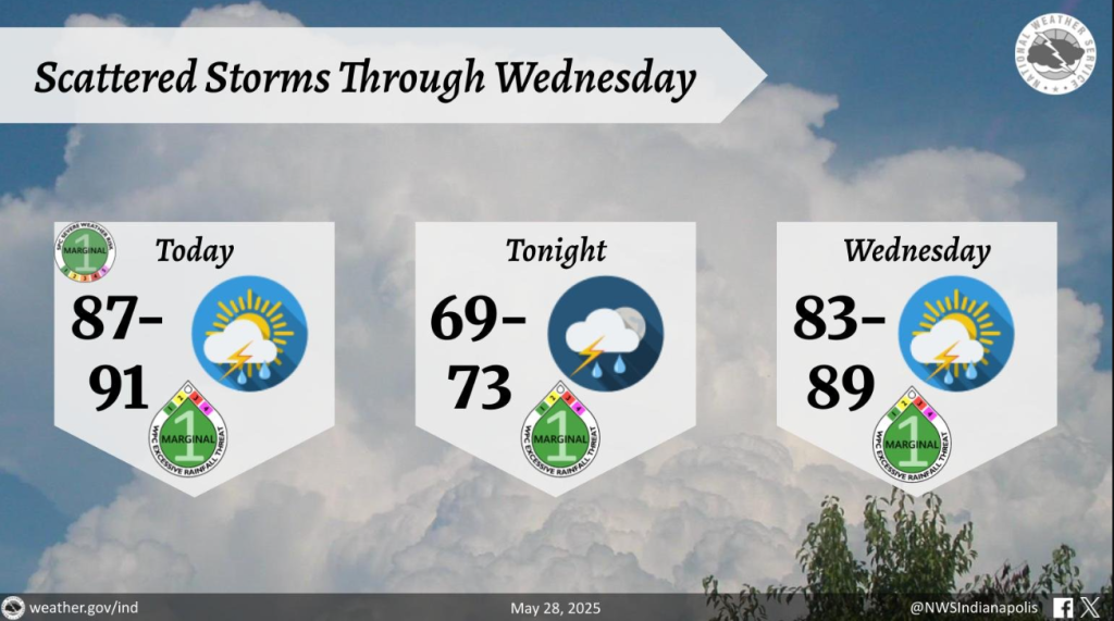
STATEWIDE — Casey Crosbie, a forecaster with the National Weather Service in Indianapolis, says the cold front will hang around Wednesday, along with a chance for thunderstorms, especially in the morning and afternoon.
“The temperatures will be dropping the next couple of days,” Crosbie says. “However, it will still be fairly humid on Wednesday, although by Thursday, expect it to be a little bit drier.”
Crosbie says the temperatures won’t be as nice as the state had about a week or so ago, where high temperatures were in the upper 70s.
“Unfortunately, it look like the state will experience another return with the heat by this weekend,” Crosbie says. “Highs will be in the upper 80s and lower 90s Friday through Sunday.”
Crosbie added after Wednesday, the chances for any precipitation are not until Sunday at the earliest.
“Even that is pretty small,” Crosbie says. “It’s about a 20% chance of precipitation on Sunday, so the rest of the week will be dry once this front comes through on Wednesday.”


