Source: X / @NWS
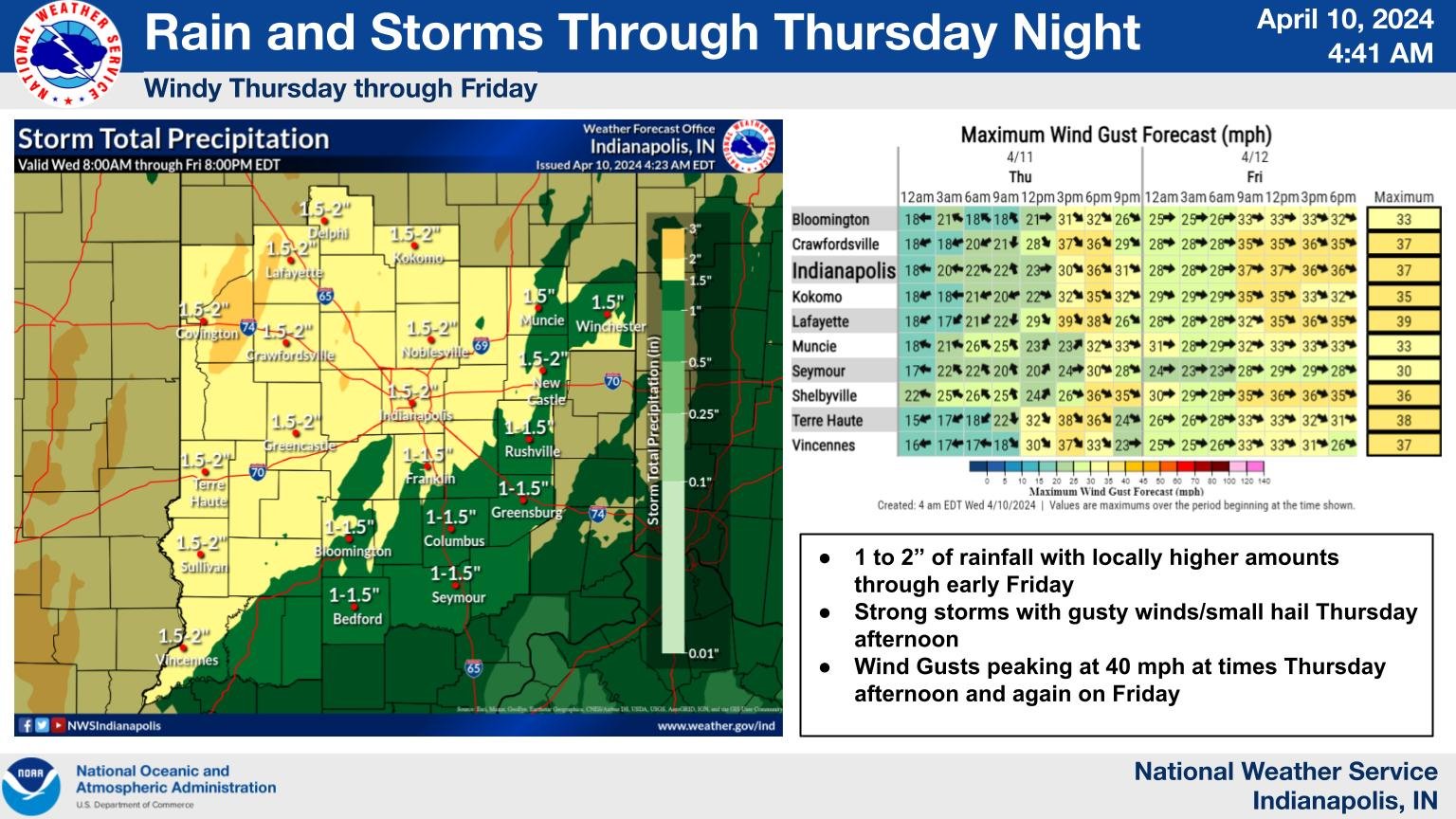
INDIANAPOLIS — In the next 24 to 36 hours, widespread rainfall is expected across the state, accompanied by the possibility of severe weather. The heaviest rain is anticipated tonight, mainly Wednesday evening through Thursday.
“We will see the heavy rain start to taper off Thursday, although we may see showers into Friday,” says Joseph Nield from the National Weather Service. For now, it appears that our highest amounts are most likely to be in the Western and northern portion of the state, maybe along the Wabash Valley, which is unfortunate because that is the area that’s been most persistently in flood here in the last couple of weeks.”
Be prepared for rain showers advancing from the south to the north this afternoon. By the evening rush hour, we anticipate widespread rainfall across Central Indiana. Nield indicates that the likelihood of severe weather will increase tomorrow, particularly to the east of Indianapolis, potentially affecting your daily commute and activities.
“Any stronger instability that may contribute to stronger thunderstorms will be held off to our south today and tomorrow night,” he said. As we go into tomorrow and tomorrow evening, we can’t rule out seeing a localized strong thunderstorm; similarly, the threat seems to be concentrated toward our east.
Nield says the strongest storms could produce strong winds and small hail.
“Even outside of thunderstorms, we are going to be seeing some fairly strong wind gusts during the day on Thursday,” he added. “We are looking at widespread gusts of 35-40 MPH into Thursday evening.”