Source: X / (Formerly Twitter)
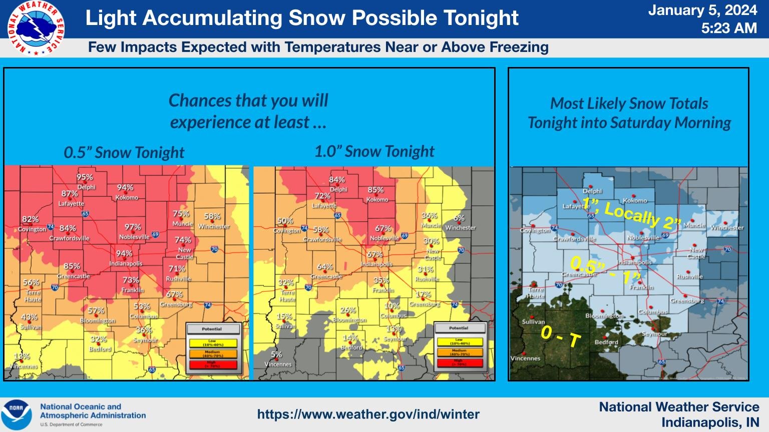
INDIANAPOLIS –Wet snow that melts on the pavements and leaves little accumulation on grassy areas is expected across Central Indiana tonight into Saturday.
“We are only looking upwards of an inch,” said National Weather Service Forecaster Sam Lashley. “North of Indianapolis Metro, possibly up to two inches in some localized areas.”
This weekend, a weather system will move through the Great Lakes and Ohio Valley region, marking the first in a series of systems that will affect the area over the next ten days. On Saturday night, a weaker system could bring a light dusting of snow.
“Then we are watching a very strong system for the early part of next week. It looks like it will mostly rain for Central Indiana, but there’s still a lot of uncertainty,” said Lashley. “Certainly some heavy snow possible, north and west of Indianapolis, especially as you get up towards Chicago.”
Lashley said it’s too early to predict what will happen next week accurately but said we are starting to see more weather patterns now that we are into winter.
“In this business, there’s not too much that’s one-hundred percent certainty,” he said. “Our confidence grows as we get to about 48-60 hours from the time the event is going to begin. One thing is for sure about the system next week: we will see strong winds on the back side of it and heavy precipitation that looks mostly like rain. We could see upwards of an inch of rain if it stays on this current track.”
Forecasters will analyze next week’s system to determine the type and amount of precipitation expected in Central Indiana.
“On Saturday, it’s pretty uniform from Central Indiana northwards in upwards of an inch (of snow), but a few spots, especially toward Logansport, Kokomo, could see up to two inches,” he added.