NWS: Sunday’s Severe Weather Outlook; Temperature Drop
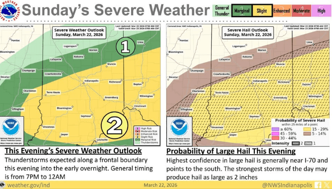
INDIANAPOLIS — After potentially tying the warmest March day on record with a high of 85 degrees Sunday, a line of severe storms is expected to sweep through Indiana Sunday night.
Andrew White, a meteorologist with the National Weather Service in Indianapolis, says the storms will likely form northwest of Indy before pushing southeast.
“We’re expecting a line of storms… probably reaching the Indianapolis area somewhere between 8:00 and 10:00,” he said.
White added the primary threats are large hail and damaging winds, with the system expected to clear out by midnight.
The storms usher in a dramatic temperature drop. By Monday morning, temperatures will plunge into the low 30s. However, the chill won’t last long, as forecasters expect a return to the 80s by the end of the week.