Rain to Bring Near-Daily Showers Across Indiana
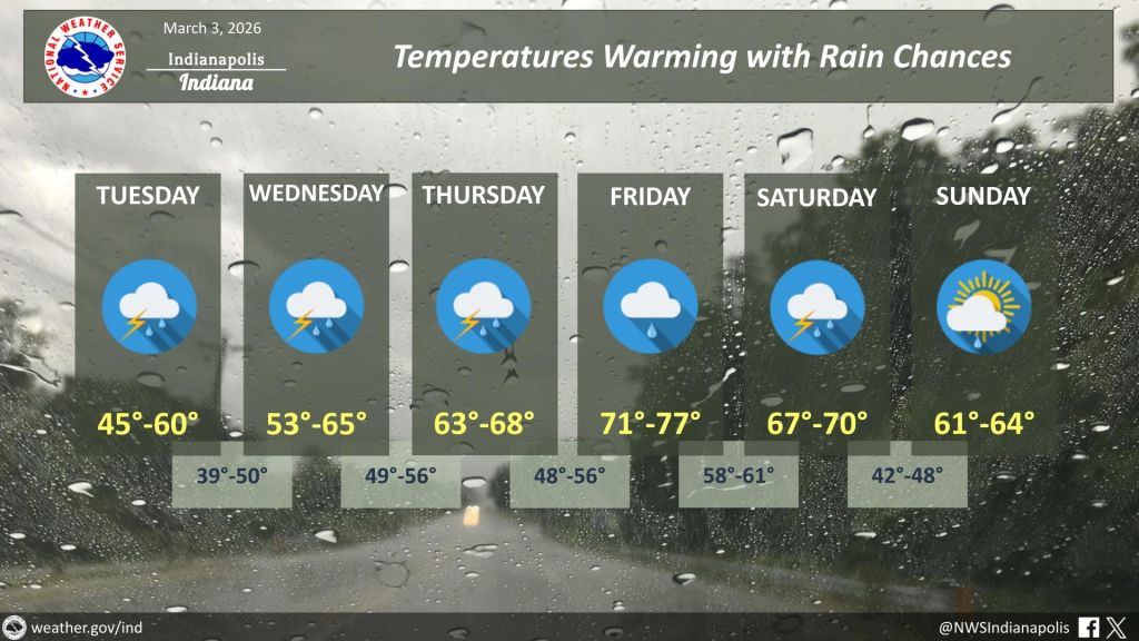
STATEWIDE — Rain moving across Indiana is expected to bring near-daily chances for precipitation through at least early next week, with potential travel impacts during heavier downpours, a forecaster said Tuesday.
Kacie Fucson, a meteorologist with the National Weather Service in Indianapolis, said much of the state will wake up to rain as a series of storm systems tracks through the region.
“We’ve got just almost daily chances for rain from Tuesday into next week,” Fucson said. “So there is a potential that, at least during times of heavier rain, it could cause some travel impacts, especially near rivers and just those lower-lying areas.”
Despite the wet pattern, Fucson said much of Indiana remains in drought conditions and can absorb additional rainfall.
According to the latest drought monitor data, areas north of Interstate 70 to near the Michigan border are experiencing moderate to severe drought, known as D2 to D3 conditions. Drought persists across most of the state.
“It’s like you have a dry sponge and then you put it underwater,” Fucson said. “The dry sponge can hold more than an already wet sponge would’ve been able to hold.”
Forecasters say the active weather pattern is being driven by an upper-level system that will keep Indiana under a mostly southwest flow, allowing repeated rounds of storm systems to move through.
“We call it an upper pattern kind of setting up, and we’re going to be under mostly southwest flow,” Fucson said. “That just means that it’s going to be a more active pattern, and that south flow will be pretty consistent, which is why we’re going to see multiple rounds of storm systems moving through.”
Temperatures are also expected to remain above average for much of March. Climate outlooks for weeks two through four indicate warmer-than-normal conditions are likely to persist, particularly for areas north of Interstate 70.
“It looks like the warmth is going to stick around for a good part of March,” Fucson said.
Forecasters advised residents to monitor updated forecasts throughout the week, especially those in flood-prone or low-lying areas.


