The Capital City is heading towards a record-breaking month for
Flooding Persists as Indianapolis Inches Towards Historic Rainfall
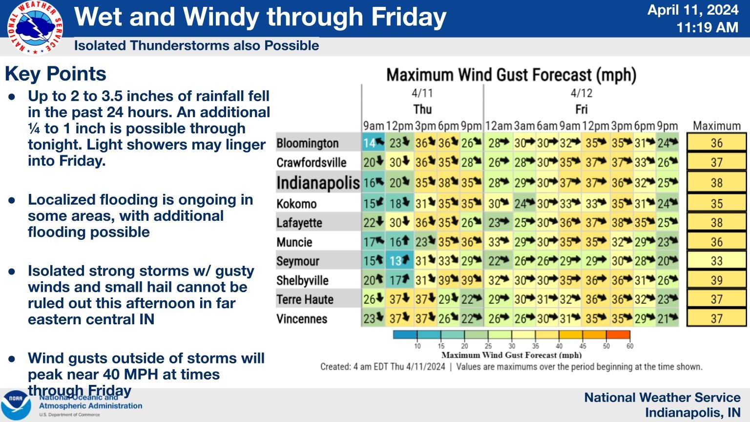
Source: X / @NWS
INDIANAPOLIS — The Capital City is heading towards a record-breaking month for rainfall, having already received nearly three and a half inches in the last 72 hours. We’re just short of six inches for April, marking one of the wettest starts we’ve ever seen.
“Think of it like a sponge,” said WISH-TV Meteorologist Marcus Bailey. “This sponge can’t hold any more water. During the last three days in Indianapolis, we have picked up 3.3 inches of rainfall. That’s an inch shy of what we should get for the entire month.”
Bailey expects light rain today. Hoosiers in Central Indiana will probably get less than a quarter of an inch, but this will make it harder for the water on flooded roads to go away.
“A lot of the creeks and streams are causing the big problems with some of these streets that have been shut down,” he says. With lots of additional rainfall today, we should start to see the water recede over the next 24-36 hours.”
Expect some windy conditions today. Winds from the west will be blowing at 25-30 miles per hour. Usually, winds this strong don’t knock down trees. But Bailey points out that because the ground is wet, the soil might become looser, increasing the risk of trees falling over in winds of up to thirty miles per hour.
The rain will taper off later today, paving the way for a pleasant and dry weekend. However, severe weather is possible in the early part of next week.
“For Tuesday into Wednesday, we will have to iron out the timeframe for the possibility of some stronger storms accompanying this system that will be moving through the Midwest,” he added.