Severe weather is coming to Indiana. Forecasters warn
NWS: Severe Weather Escalates from This Afternoon through Tuesday
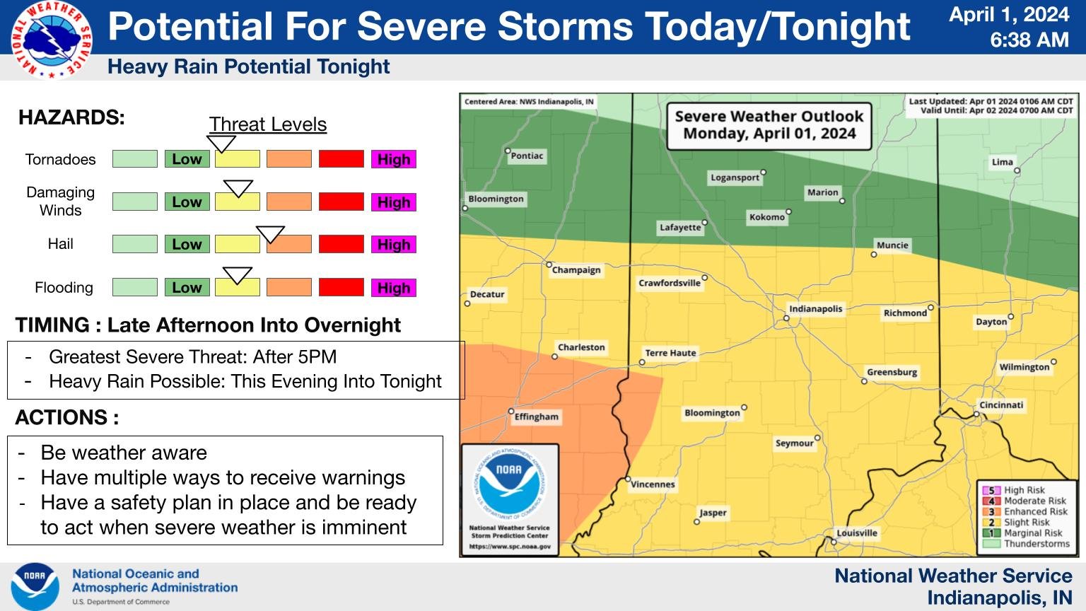
Source: X / @NWS
INDIANAPOLIS –Severe weather is coming to Indiana. Forecasters warn that we could see strong winds, hail, and even tornadoes. They predict that this bad weather might arrive during Monday evening rush hour and could continue to affect Tuesday morning’s commute.
“The pattern looks active not only Monday but into Tuesday,” said Greg Melo, National Weather Service. “Looks like we are going to have the potential for severe weather, mainly this evening, which is the main threat today, but don’t be fooled. We could see severe weather tonight and overnight.”
Melo said that the areas most affected by damaging wind gusts and tornadoes are expected to be in Southern Indiana, especially near and south of the I-70 corridor. However, a large portion of the state is also at risk of experiencing significant hail. Aside from the severe weather, there’s also a possibility of flooding.
Melo added that the exact timeline for severe weather to move into the area is anytime after 4:00 p.m.
“We could have a brief lull in severe storms into Tuesday morning, then as we get into Tuesday afternoon, we could see more storms fire up in the afternoon hour with the potential for severe weather,” he said. “The first round of thunderstorms will happen this afternoon and then another round Tuesday, and that threat will diminish on Tuesday evening.”
Melo mentioned that snow is also forecast for Tuesday, and the amount we get will depend on how warm or cold the ground is.
“Where we have less confidence is in snowfall amounts,” he said. “We are not sure how much will accumulate on the grass or the roads.”