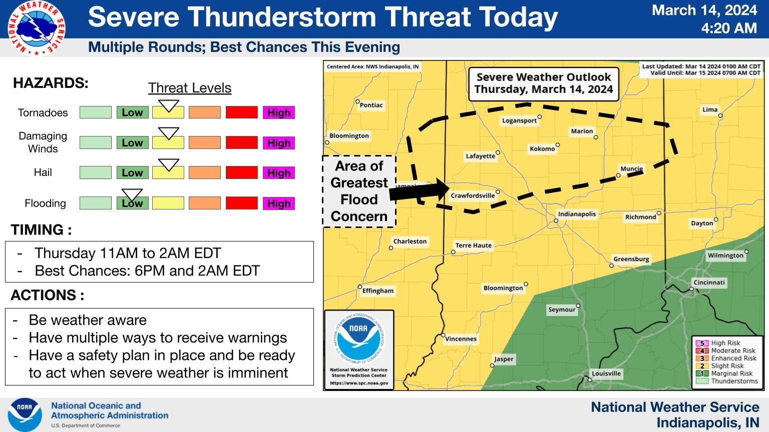
Possible tornados, hail, and strong winds are expected to sweep
NWS: Multiple Rounds of Severe Weather Likely
Source: X / NWS
INDIANAPOLIS — Several rounds of severe weather will sweep the state today, and the day kicked off with elevated thunderstorms, accompanied by lightning and heavy rain, to the northeast and northwest of Indianapolis.
“The primary severe weather risk is going to be in that 6 pm to 7 pm until about 10 pm timeframe,” said National Weather Service Meteorologist Aaron Updike. “That will be across Central Indiana more so than Northern Indiana.”
Forecasters want Hoosiers to stay weather-aware and monitor their media sources for any warnings or watches issued this afternoon or this evening.
“Also, make sure you have your severe weather preparedness kits,” said Updike. “That way, when you do have to get in action for a severe thunderstorm or tornado warning, you’re ready.”
Severe weather kits are equipped with essential items to ensure your safety and comfort during severe weather events. These include a three-day supply of non-perishable food, a gallon of water per person per day, a battery-powered or hand-crank radio, a flashlight with extra batteries, a first aid kit with medications, a whistle for signaling, dust masks, moist towelettes, and sanitation supplies.
“This morning, across Central Indiana, you should be fine,” said Updike. “If you’re in Northern Indiana, just be prepared for some quick shots of heavy rain. Just look out for ponding on roadways. If you are traveling anytime between 11 am – and 3 p.m. p.m., if you see a severe thunderstorm warning, do not drive into it. Either drive to a local gas station or store to wait it out. Just driving in severe thunderstorms can be dangerous.”
According to Updike, a line of storms will occur in the morning and last for approximately an hour before they move out. The next round of storms will come through around 3:00 PM. The third and final round of storms, mainly wind events, will happen at around 10:00 PM tonight.