Source: X / NWS
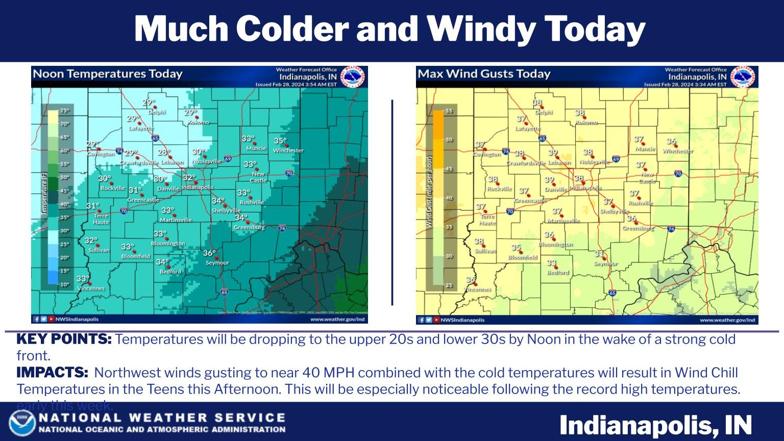
INDIANAPOLIS –Powerful thunderstorms, driven by a strong weather system moving away from the state, brought about a rapid temperature drop of almost 40 degrees at Indianapolis International Airport early Wednesday morning.
However, this temperature drop is expected to be short-lived, as forecasters predict a warm-up over the coming weekend.
“Fortunately, we are not going to be in the deep freeze like we were in January,” said National Weather Service Meteorologist Joseph Nield. “By Friday, we are talking about the mid-40s to maybe nearing 50 and by this weekend, nearing 60 and maybe even some 70s sneaking in there.”
In Northern Indiana, most of the severe weather missed the area, concentrated in northern Illinois and southwest Lower Michigan.
“We do have an area of a brief shot of snow,” said forecaster Nathan Marsili. “We are looking at some observations across northwest Indiana and looking about a quarter-mile with a brief shot of this snow.”
Marsili explained that the sudden temperature drop felt by Hoosiers on Wednesday was part of a powerful system associated with a 60-degree temperature decrease experienced across Iowa, extending from the northwest to the southeast of the state.
Tuesday night saw severe weather across the Chicago area, with strong thunderstorms, heavy lightning, golf-ball-sized hail in some parts, and reports of up to five tornadoes.
According to Marsili, there have been no reports of tornadoes in Indiana.
“We did issue one tornado warning, but it doesn’t appear there was any damage in that area,” he added.
Nield said temperatures will continue to drop in Central Indiana, accompanied by strong winds.