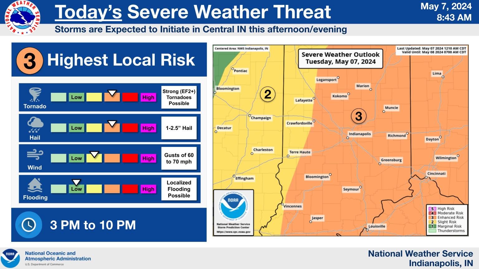
Today, the state is at risk of strong winds, large hail,
Indiana Prepares for Severe Storms, Tornado Risk Elevated
Source: X / @NWS
INDIANAPOLIS —Today, the state is at risk of strong winds, large hail, and even tornadoes. The worst of the weather is expected after 6 p.m.
“We are expecting redevelopment of thunderstorms around 3-4 PM,” said Aaron Updike of the National Weather Service. “The initial thunderstorms that develop could be severe, but we expect the most potent severe storms to happen in the 6 pm timeframe, and with that, strong tornadoes are possible today. Strong tornadoes meaning EF2 or greater.”
Updike says that tornadoes could hit anywhere in the state, but the highest risk areas are along the I-69 corridor, especially east and south of there, including Indianapolis, Muncie, and Bloomington.
“If you’re not in those areas, say that you’re west of there, it doesn’t mean that you’re out of the risk; it just means that you have a little bit less of a risk,” he said. “We are looking at the potential for strong tornadoes today. This is not a day to take lightly, but we want to ensure you are weather-aware.”
Updike suggests having a safe place identified and ensuring your phone is charged to receive emergency alerts. If a tornado occurs at night, keep your phone nearby and heed tornado watches or warnings. Updike also notes the possibility of severe weather on Wednesday.
“Tomorrow, it looks like the trends are pushing the threat into Southern Indiana, so the rest of Indiana isn’t out of the threat, but the greatest threat, especially for damaging winds and tornadoes, is going to be in that Bloomington to Columbus on south area,” said Updike.


