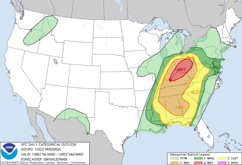
All of Indiana is at risk of severe weather today, including tornado
Severe Weather Expected with Tornadoes, Hail, and Wind
Source: x / @NWS
INDIANAPOLIS — All of Indiana is at risk of severe weather today, including tornadoes, hail, and straight-line winds.
“The storms this afternoon will be moving quite quickly,” said National Weather Service Forecaster Matthew Eckhoff. “So, their chance of dropping a lot of rain in a prolonged time is quite low. So the flooding threat is diminishing, but the overall severe threat has increased.”
The National Weather Service has put out a flood watch for all of Central Indiana because of the predicted heavy rain on Tuesday. This watch is supposed to end this afternoon. However, another round of storms is expected to start later today, bringing the potential for severe weather.
“All of Central Indiana has a chance for storms today, including Northern Indiana and Southern Indiana,” Eckhoff said. “But the storms take a couple of hours to get to full strength. The greatest severe chance will be is east toward the Ohio/Indiana state line and eastward.”
Eckhoff emphasized the potential severity of these storms, warning of the possibility of large hail and tornadoes. He advises everyone to take all possible precautions in case these events occur.
“If you get a tornado warning, seek shelter in the lowest level in a house or a bathtub,” he said.
The severe weather threat is expected to start between 1-3 pm.