Source: Twitter / NWS
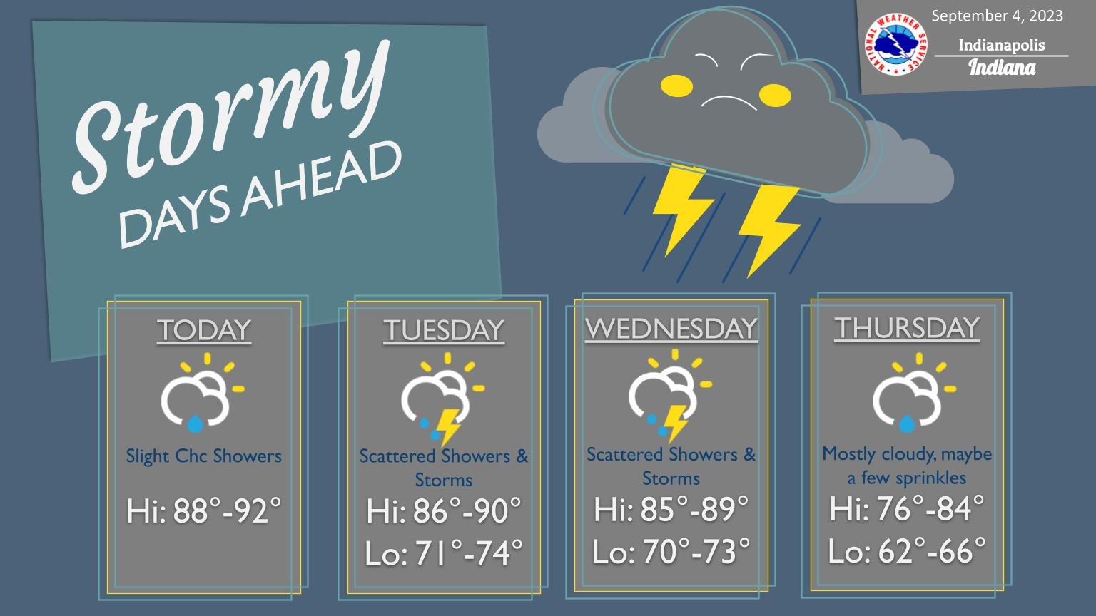
INDIANAPOLIS — Hoosiers will be dealing with some rain chances for the first time. The National Weather Service says you can expect a shift in the weather pattern. Still, as far as today, Central Indiana will be generally dry, with some showers possible toward the Terra Haute area, but more widespread storms are expected on Tuesday and Wednesday.
“Most of Indiana from North to South will be anywhere from the upper 80s to 90 degrees,” said Andrew White of the National Weather Service. “That’s going to be the same thing for the next couple of days with temperatures in the upper 80s.”


With the start of fall less than three weeks away, White said Indiana’s average temperatures are slightly warmer than usual.
“We’re going to get a little blast of cooler air later this week where we will see temperatures closer to normal, around 80 to the upper 70s. [We will feel] chiller temperatures at night this weekend with lows in the 50s,” he said. “That’s not going to stick around too long because we’re bouncing between that slightly warmer than normal to near normal through the middle of the month.”
Forecasters believe severe weather won’t be widespread on Wednesday, but there is still a chance.
“It’s going to be warm through Wednesday, and you’re going to see scattered showers and thunderstorms during the afternoon hours on Tuesday and Wednesday,” he added. “Thursday, we’ll see cooler temperatures moving back in.”