Heat Returns Across Indiana with Spotty Storms
STATEWIDE — Isolated storms are possible this afternoon, mainly south and east of Indianapolis.
After last night’s rain, most areas are dry but humid this morning. “We’re not expecting any severe weather today,” said Greg Melo of the National Weather Service in Indianapolis. “Any thunderstorms that develop, lightning is always a hazard, and we could have some brief, heavy rain, but we aren’t expecting any flooding today.”
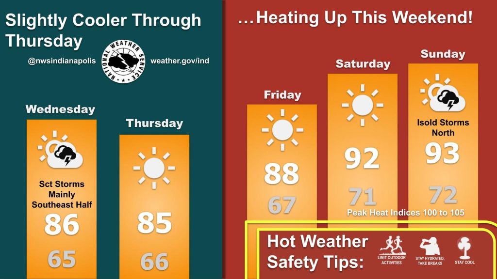
Tonight should be quiet, with patchy fog and lows in the mid-60s. Thursday looks clear, with sunshine, lower humidity, and comfortable summer temperatures.
High heat returns Friday through the weekend, with temperatures reaching the mid-90s and heat indexes near 100°F. Melo said, “Compared to the past few summers, we have been abnormally hot. The past few summers we had a lot of cold fronts that gave us relief, but this year we really only had one good push of cooler, dry air.”
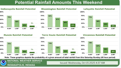
A few scattered storms could appear Sunday and Monday, but widespread relief from the heat remains limited.