Showers and thunderstorms are redeveloping across the area
NWS: Thunderstorms, Hail, and Snow Ahead
Source: X / NWS
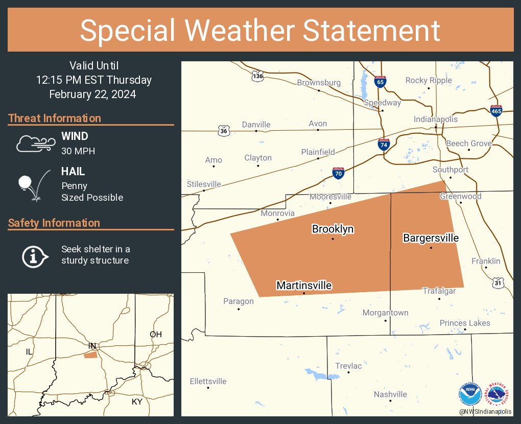
INDIANAPOLIS — Showers and thunderstorms are redeveloping across the area and will continue to move East and Southeast across Central Indiana through mid-afternoon. Forecasters are not anticipating any severe weather, but Hoosiers will see intense storms accompanied by pea-sized hail and lightning.
“It’s unusual sometimes to see storms with hail here in February,” said Forecaster Mike Ryan. “Especially after we just went through the snow and a pretty cold stretch.”
Indiana’s weather roller coaster continued on Wednesday with a near-record high temperature of 68 degrees. The most likely chance for hail will be between noon and three o’clock in the early to late afternoon.
“That is about 20-25 degrees above normal for this time of year,” said Ryan. “Quite a change from where we were four days ago, and the roller coaster ride will continue into next week.”
The National Weather Service said we can expect another round of light snow.
“That may produce some minor accumulation across the area,” added Ryan. “Saturday will be chilly so that it will be a return to winter, and then we will shift right back into a warmer pattern next week.”


