Indiana Could See Light Snow into New Year’s Eve
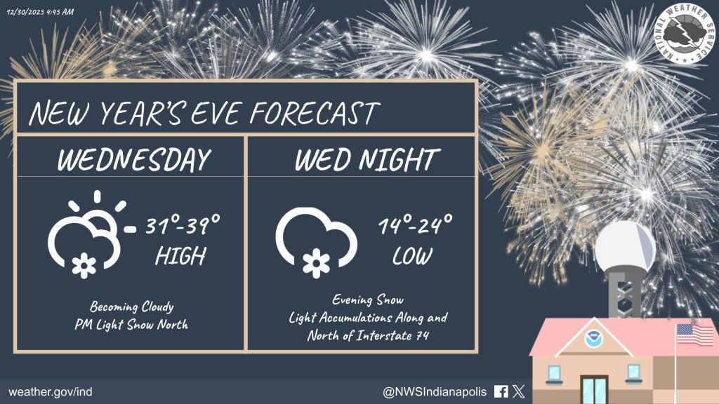
INDIANAPOLIS — Central Indiana could see light snow as we head into New Year’s Eve, though significant impacts are not expected.
Mike Ryan from the National Weather Service says a weak system moving just north of the area could bring scattered snow later Wednesday, mostly in the evening.
“We’re not really anticipating any impacts with this first round,” Ryan said. “But people may see a few snowflakes flying around.”
On New Year’s Eve, a stronger system is expected to move in. Forecasters say a front will reach northern Indiana by mid to late afternoon, hitting Lafayette, Kokomo, and Muncie first, and arrive in the Indianapolis area around sunset.
That timing lines up with people traveling for New Year’s celebrations.
“We’ll see a period of light snow extend through the evening, which is really the worst possible time when people are out and about,” Ryan said.
Snow is expected to taper off and shift east after midnight, likely ending by around 3 a.m. Thursday. While snowfall amounts are expected to be modest, some light accumulation is possible, particularly north of Interstate 74.
Forecasters are calling for around a half-inch of snow in a broad area stretching from Crawfordsville through Indianapolis and toward Greensburg. Higher totals, potentially just over an inch, are possible farther north near Kokomo and Muncie.
“It’s not a lot of snowfall, but with more people on the roads, it’s something to keep an eye on,” Ryan said. “Allow a little extra time to get where you’re going.”
After the snow exits, colder air will move in behind the system. High temperatures Thursday are expected to remain in the 20s before gradually warming later in the week.
Temperatures are forecast to climb back into the 30s and potentially the 40s by Sunday and Monday. Ryan said the weather pattern should remain relatively quiet into early next week, with little chance for additional precipitation as most larger storm systems stay south of central Indiana.
Looking ahead, Ryan said there are early signs of a return to colder, more unsettled weather later in January.
“Not necessarily during the first week,” he said, “but as we get into the second week of January and beyond, we may see a transition back to more active winter weather across the state.


