Storm Risk for Central, Southern Indiana

INDIANAPOLIS — Strong storms could impact parts of central and southern Indiana later today, with damaging winds and heavy rain the main concerns.
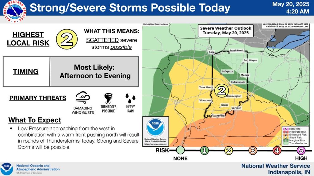
The National Weather Service has placed areas south of Indianapolis under a slight risk for severe weather between 2 and 9 p.m. All types of severe weather are possible, including isolated tornadoes, with the highest risk focused on the southern half of the state.
This morning, a warm front moved through, bringing widespread rain and a few strong storms to southwestern Indiana, where a tornado watch was issued. That rain is expected to ease by early afternoon, but a cold front moving in later today may trigger another round of storms, some of which could become severe.
Rain totals could reach 1 to 2 inches in some locations, raising concerns about localized flooding.
Temperatures today will remain in the 60s under thick cloud cover, about 10 degrees cooler than Monday.
Looking ahead, cloudy skies and spotty showers will continue through Wednesday and Thursday, with highs in the 50s and 60s and a chilly northwest wind making it feel more like early spring.
Conditions are expected to improve by Friday. Carb Day should be dry with some sun and highs in the mid-60s.
The holiday weekend starts dry, with Saturday bringing a mix of sun and clouds and highs in the mid-60s.
For the Indy 500 on Sunday, there’s a chance for some morning showers in southern Indiana, but much of the state could stay dry with highs near 70.
Memorial Day brings a slight chance of rain, but it’s not expected to be a washout. Skies will be partly cloudy with highs in the low 70s.


