Triple Digit Trouble: Indiana Faces Heat Advisory
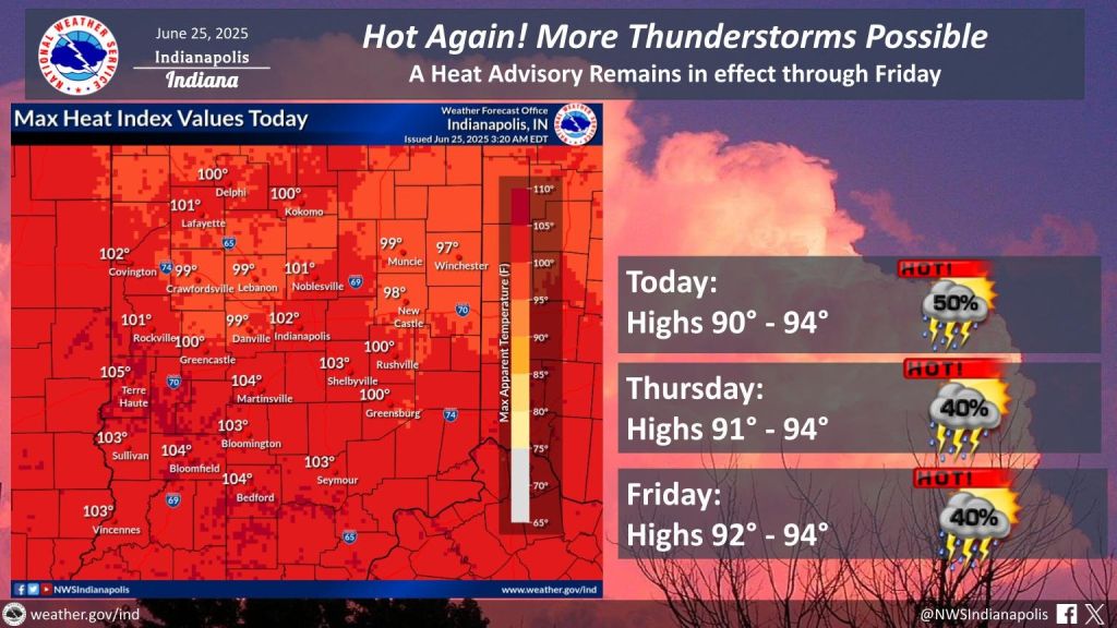
INDIANAPOLIS — It’s going to be another hot day across much of Indiana on Wednesday. Temperatures will climb into the lower 90s, which is about 8 to 10 degrees warmer than normal for this time of year.
And with the humidity, it’s going to feel even hotter, with heat index values reaching the triple digits.
If you can, try to stay indoors and keep yourself hydrated — the heat advisory is in effect all week long.
Later this afternoon, we could see some scattered showers and thunderstorms pop up. Some of those storms might bring gusty winds and heavy rain. There’s even a small chance a few could get a little severe, mainly because of the wind. The best chance for those storms will be after lunch and into the early evening.
Tonight, any leftover storms should wind down, but it’ll still feel muggy and mild, with lows in the low to mid-70s.
Thursday’s looking pretty much the same — hot and sticky, with highs again in the lower 90s and heat index values topping 100. You might see a few afternoon or evening showers and storms again.
No real break overnight, either, as temperatures stick around the 70s.
Looking ahead to the weekend, it’ll stay hot and humid with highs near 90. Afternoon storms are possible Saturday and Sunday, so keep an eye on the sky if you’re heading out.